
Pachmarhi travel guide · Satpura hills, Madhya Pradesh
18 Best Places to Visit in Pachmarhi(with Map, Timings & Distances)
Waterfalls, 2,000 year old caves, Shiva shrines and the Dhoopgarh sunset, with the distance from the bus stand, the time each place needs and the best season to go.
- 18 places
- 52 km from Pipariya
- 1,067 m above sea level
Pachmarhi is the only hill station in Madhya Pradesh, a green plateau in the Satpura hills, 52 km above Pipariya railway station. Its best places are waterfalls like Bee Falls and Rajat Prapat, the Pandav Caves, the Shiva shrines at Jata Shankar, Bada Mahadev and Chauragarh, and the sunset at Dhoopgarh, the highest point in Madhya Pradesh.
Most places sit within 15 km of the bus stand. Two days cover the main sights and three days let you see them all. Many forest points can only be visited by gypsy, so it helps to plan the order. Here are all 18, with the distance from the bus stand.
The 18 places to visit in Pachmarhi
- Christ Church · 1 kmBuilt by the British in 1875.
- Jata Shankar · 1.5 kmA cave shrine at the bottom of a narrow gorge.
- Pandav Caves · 2 kmFive caves cut into a low sandstone hill, the caves that gave Pachmarhi its name.
- Bison Lodge Museum · 2 kmThe first house in Pachmarhi, built by Captain Forsyth in 1862.
- Pachmarhi Lake · 3 kmA quiet lake at the edge of town with pedal boats and a walking path.
- Apsara Vihar · 3 kmA shallow pool under a small fall of about 30 feet.
- Rajat Prapat (Silver Fall) · 5 kmThe Silver Fall drops 107 metres in a single white line.
- Bee Falls (Jamuna Prapat) · 5 kmThe waterfall families love most.
- Ramya Kund (Irene Pool) · 6 kmAlso called Irene Pool, after Irene Bose, who found it.
- Duchess Falls · 7 kmThree cascades that fall about 100 metres in all.
- Reechgarh · 5 kmA natural rock amphitheatre with a cave rift you walk through from one side to the other.
- Rajendragiri · 5 kmA garden viewpoint named after Dr Rajendra Prasad, India's first President, who stayed in Pachmarhi.
- Handi Khoh · 5 kmA ravine about 300 feet deep with sheer walls and thick forest at the bottom.
- Priyadarshini Point (Forsyth Point) · 6 kmThe spot from where Captain Forsyth first looked over the plateau in 1857, long known as Forsyth Point.
- Bada Mahadev · 11 kmA cave about 60 feet long where water drips on the Shivling all year.
- Gupt Mahadev · 13 kmA shrine at the end of a 40 foot passage so narrow that people enter one at a time.
- Chauragarh · 15 kmA Shiva temple on a summit at about 1,330 metres, reached by roughly 1,300 steps.
- Dhoopgarh · 11 kmAt 1,352 metres, the highest point in Madhya Pradesh and in the whole Satpura range.
Pachmarhi Tourist Places Map

Map of the 18 places to visit in Pachmarhi with distance from the bus stand. Positions are approximate; use the numbered list for exact distances.

The Road from Pipariya to Pachmarhi
The journey begins
Pipariya town ends here. The road turns south, and the Satpura hills show as a blue line ahead.
Matkuli
The last town on the plains and the usual tea halt. The road crosses the Denwa river here.
The ghat begins
You enter Satpura Tiger Reserve. For the next 20 km the road climbs through sal and teak forest.
On this stretch. Langurs sit on the parapets and Indian giant squirrels move through the canopy. Gaur, the Indian bison, graze at the forest edge early in the morning.
Pachmarhi
The plateau opens out. Bus stand, market and the old cantonment sit close together. Every distance below is measured from this bus stand.
History of Pachmarhi
- Prehistory
- Rock shelters in these hills hold paintings, the oldest dated to around 10,000 years.
- Legend
- The Pandavas are said to have spent part of their exile here. “Panch marhi” means five caves.
- 1857
- Captain James Forsyth of the Bengal Lancers reached the plateau.
- 1862
- Forsyth built Bison Lodge, the first house here.
- British era
- A sanatorium and cantonment, and summer capital of the Central Provinces.
- 2009
- UNESCO listed the Pachmarhi Biosphere Reserve.
Places to Visit in Pachmarhi Town
Five places within 3 km of the bus stand. An easy first afternoon.
Christ Church
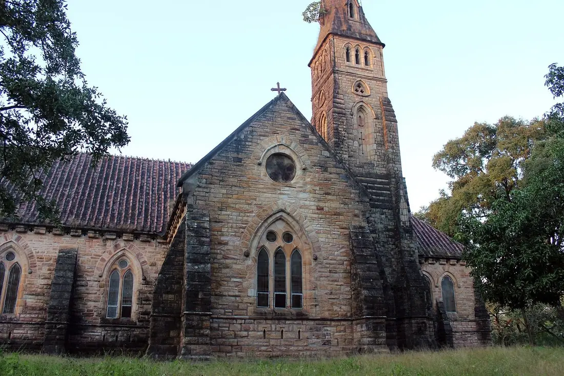
Built by the British in 1875. Sandstone walls, a domed altar and stained-glass windows that light up in the morning sun.
- Time
- 20 minutes
- Effort
- Easy
- Good to know
- Sunday service is still held here.
Jata Shankar
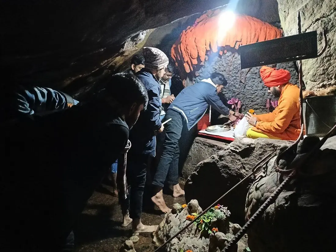
A cave shrine at the bottom of a narrow gorge. The rock overhead hangs like Shiva's matted hair, and the story says Shiva hid here from Bhasmasur.
- Time
- 45 min to 1 hour
- Effort
- Moderate. A walk and steps down into the gorge.
- Good to know
- Footwear comes off near the shrine. Rocks are wet in the monsoon.
Pandav Caves
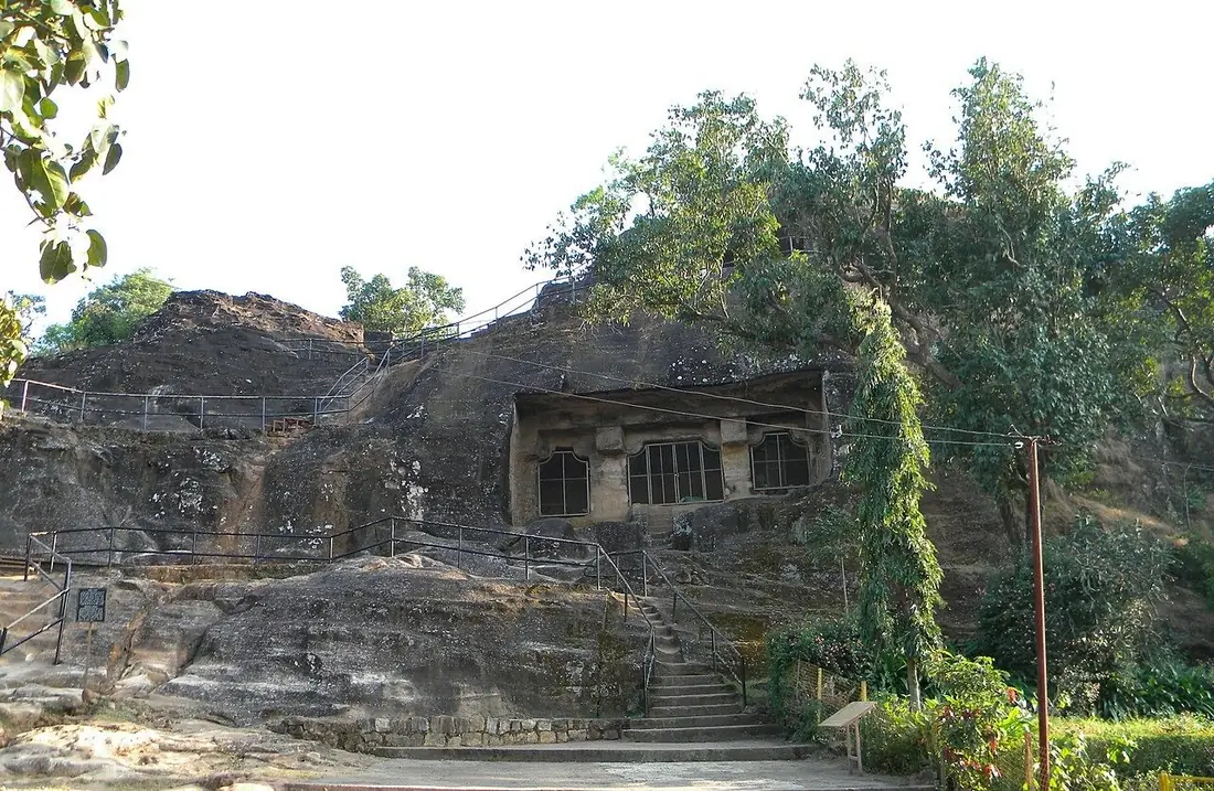
Five caves cut into a low sandstone hill, the caves that gave Pachmarhi its name. Legend gives them to the Pandavas; archaeologists read them as Buddhist cells from around the 1st century.
- Time
- 30 to 45 minutes
- Effort
- Easy. A short climb, with a garden in front.
- Good to know
- Go in the morning, before the tour groups.
Bison Lodge Museum
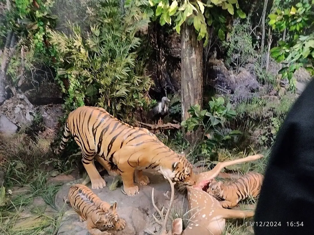
The first house in Pachmarhi, built by Captain Forsyth in 1862. Today it is a small museum of the Satpura forest: its animals, birds and plants.
- Time
- 30 to 45 minutes
- Effort
- Easy
- Good to know
- Check the weekly closing day before you go.
Pachmarhi Lake
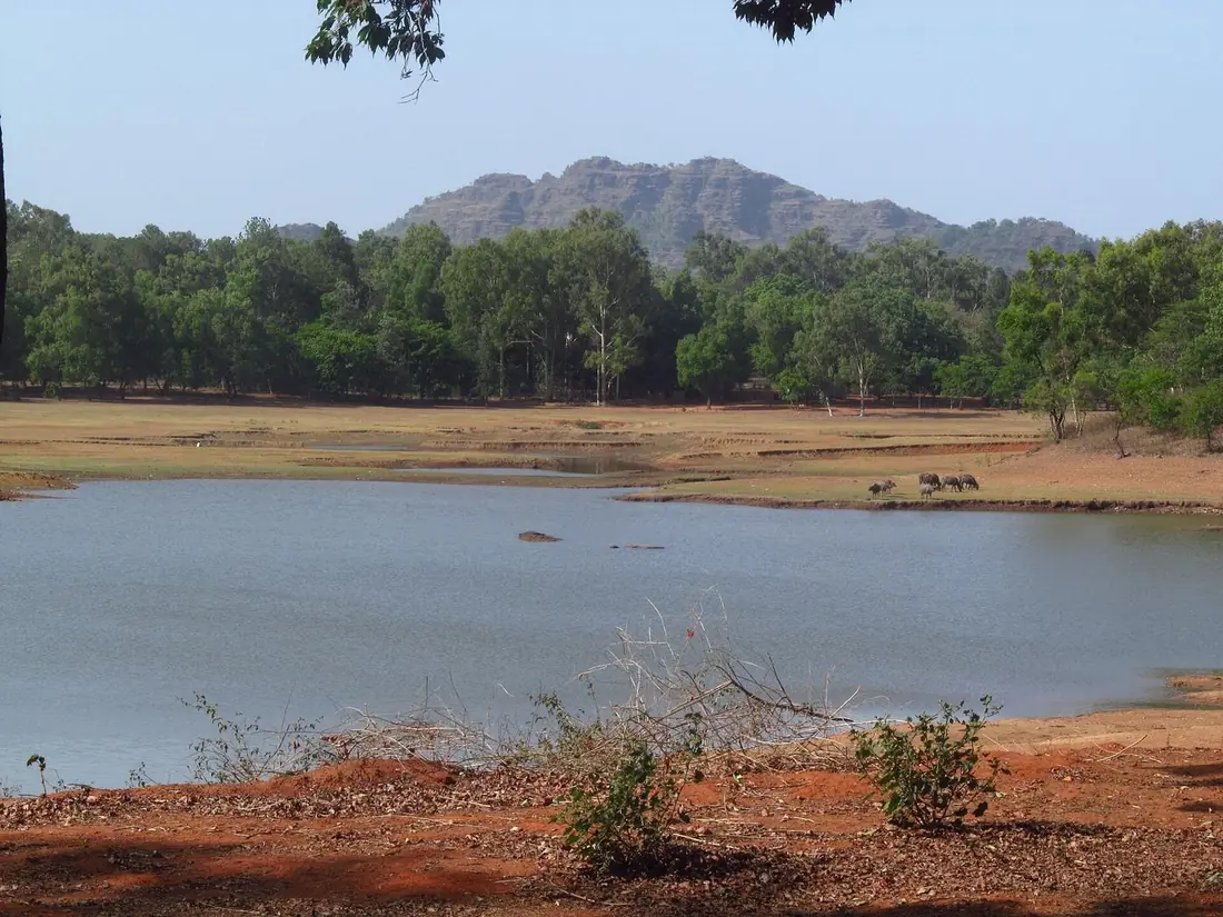
A quiet lake at the edge of town with pedal boats and a walking path. A good place to end the first evening.
- Time
- 45 minutes
- Effort
- Easy
- Good to know
- Boating closes before dark.
Birds to look for. The Malabar whistling thrush sings near streams at dawn. Crested serpent eagles circle over the valleys, and the Indian paradise flycatcher, the state bird, nests here in summer.
Waterfalls in Pachmarhi
Five falls and pools in the forest zone. These need a forest entry ticket and are usually done by gypsy.
Apsara Vihar
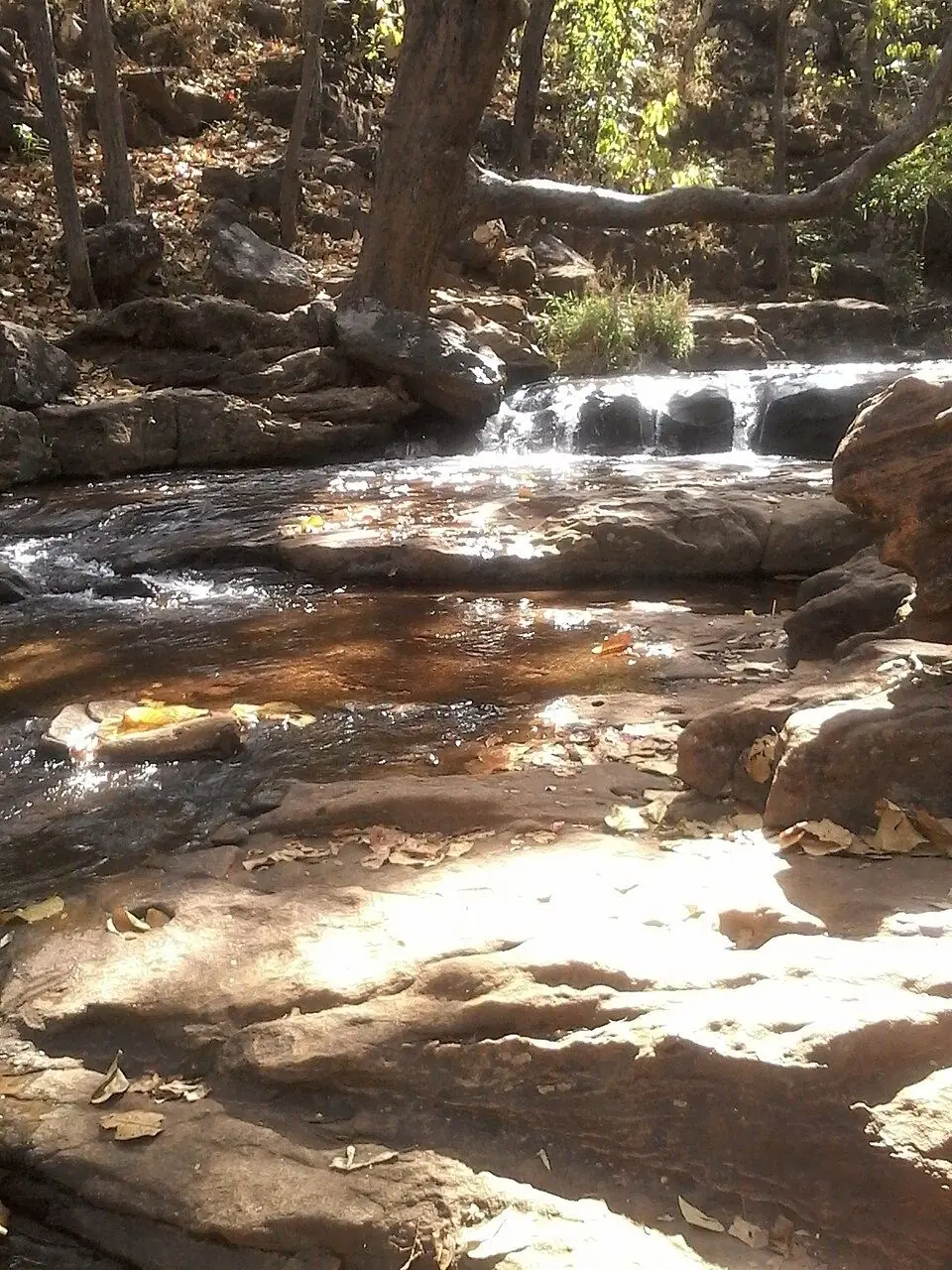
A shallow pool under a small fall of about 30 feet. The safest place in Pachmarhi for a swim, and the one children like best.
- Time
- 1 hour
- Effort
- Moderate. About 1.5 km downhill on foot, and the same back.
- Good to know
- Carry a change of clothes.
Rajat Prapatalso called Silver Fall
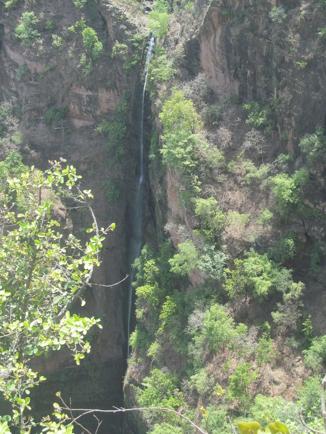
The Silver Fall drops 107 metres in a single white line. It is a 10 minute walk over rocks from Apsara Vihar.
- Time
- 45 minutes from Apsara Vihar
- Effort
- Moderate. Boulders underfoot.
- Good to know
- Best from August to January. Wear shoes with grip.
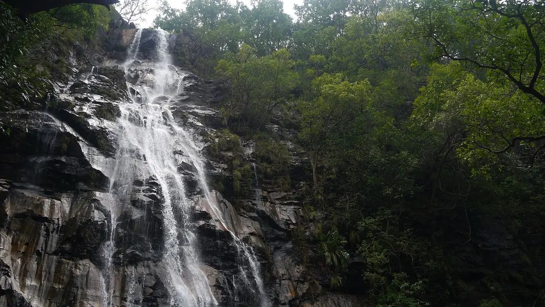
Bee Fallsalso called Jamuna Prapat
The waterfall families love most. The stream drops about 35 metres into a pool you can stand under, and the same stream supplies the town's drinking water.
- Time
- 1.5 to 2 hours
- Effort
- Moderate. A long stepped descent, and the same climb back.
- Good to know
- Strongest flow from July to February.
Ramya Kundalso called Irene Pool
Also called Irene Pool, after Irene Bose, who found it. A clear pool in a forest stream with far fewer visitors than Bee Falls.
- Time
- 1 hour
- Effort
- Moderate. A steep path of about 300 m down to the pool.
- Good to know
- Good for a quiet dip on a crowded weekend.
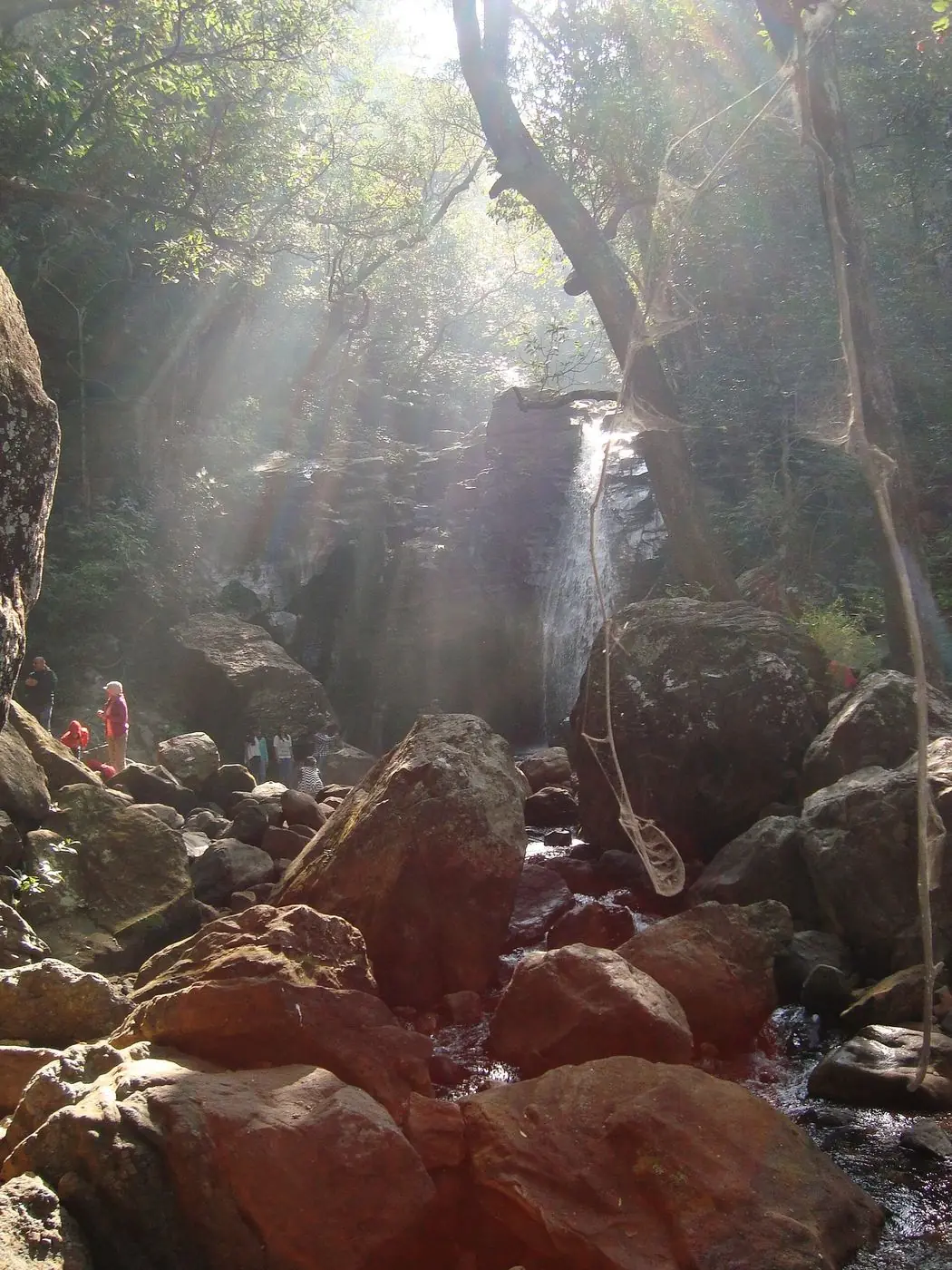
Duchess Falls
Three cascades that fall about 100 metres in all. The hardest waterfall in Pachmarhi to reach, and the emptiest.
- Time
- 3 to 4 hours
- Effort
- Hard. A steep trek of almost 4 km.
- Good to know
- For fit walkers only. Start in the morning and carry water.
In the forest. Satpura Tiger Reserve holds tiger, leopard, sloth bear and wild dog. Sightings near town are rare; the safari zone at Madhai is where people go to look for them.
Best Viewpoints in Pachmarhi
Short stops with long views. Most gypsy circuits club these together.
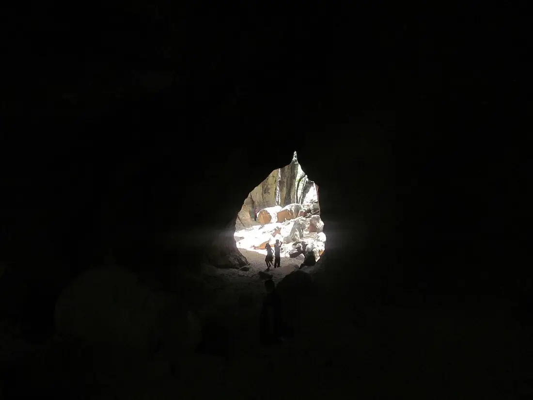
Reechgarh
A natural rock amphitheatre with a cave rift you walk through from one side to the other. Bears once sheltered here, which gave the place its name.
- Time
- 30 to 45 minutes
- Effort
- Easy to moderate. Uneven rock underfoot.
- Good to know
- The caves stay cool even in May.
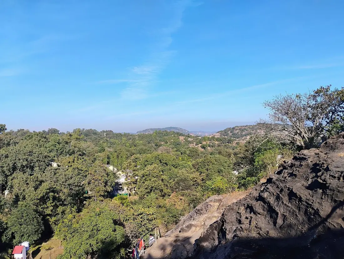
Rajendragiri
A garden viewpoint named after Dr Rajendra Prasad, India's first President, who stayed in Pachmarhi. Rolling forest in every direction.
- Time
- 30 minutes
- Effort
- Easy
- Good to know
- A calmer sunset than Dhoopgarh.
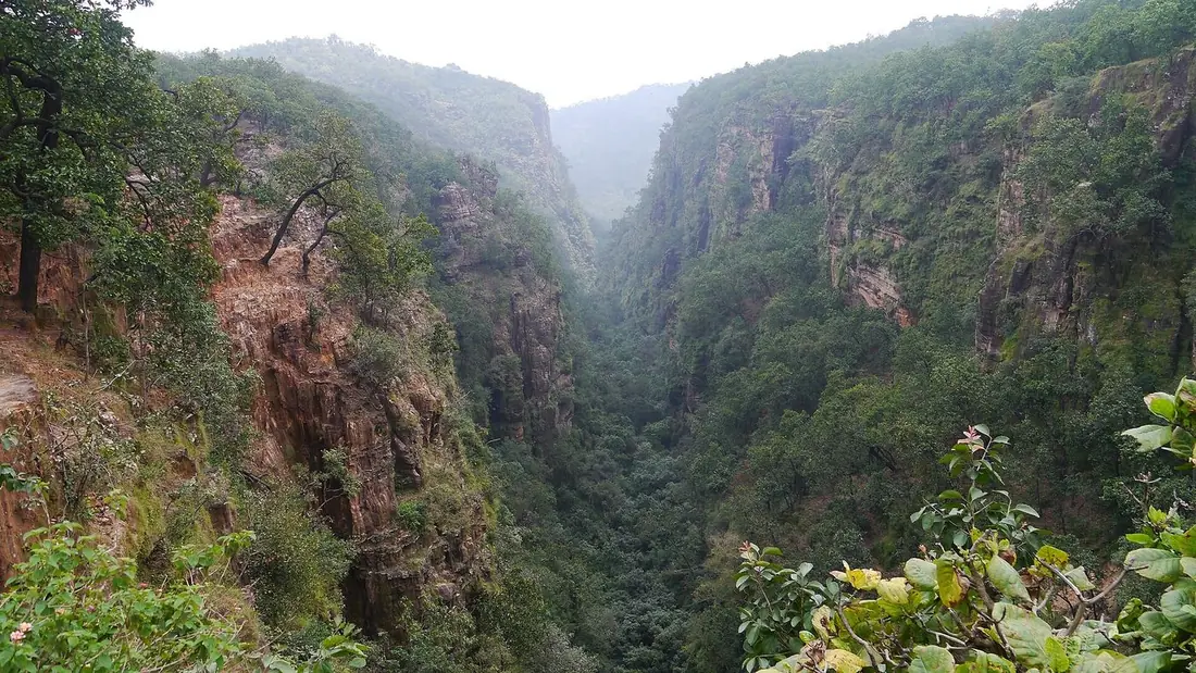
Handi Khoh
A ravine about 300 feet deep with sheer walls and thick forest at the bottom. You hear the water long before you see it.
- Time
- 20 to 30 minutes
- Effort
- Easy. A flat walk from the parking.
- Good to know
- Clear mornings give the longest view.
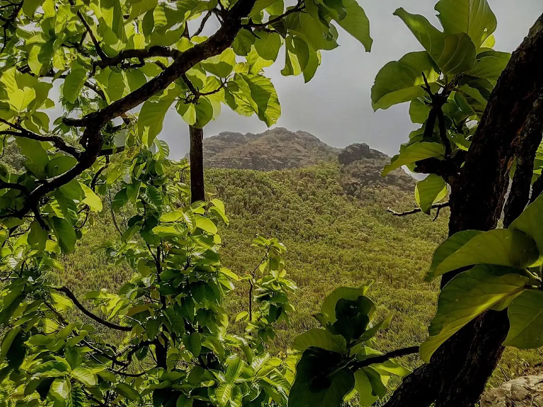
Priyadarshini Pointalso called Forsyth Point
The spot from where Captain Forsyth first looked over the plateau in 1857, long known as Forsyth Point. Chauragarh, Mahadeo and Dhoopgarh line up on the horizon.
- Time
- 20 to 30 minutes
- Effort
- Easy
- Good to know
- The best single photograph of the Satpura skyline.
Temples in Pachmarhi
Three Shiva shrines at the far end of the plateau. Keep half a day.
Bada Mahadev
A cave about 60 feet long where water drips on the Shivling all year.
- Time
- 30 to 45 minutes
- Effort
- Easy
- Good to know
- Langurs wait near the parking; keep food packed.
Gupt Mahadev
A shrine at the end of a 40 foot passage so narrow that people enter one at a time.
- Time
- 30 minutes
- Effort
- Easy, but a tight squeeze.
- Good to know
- Skip the passage if closed spaces bother you.
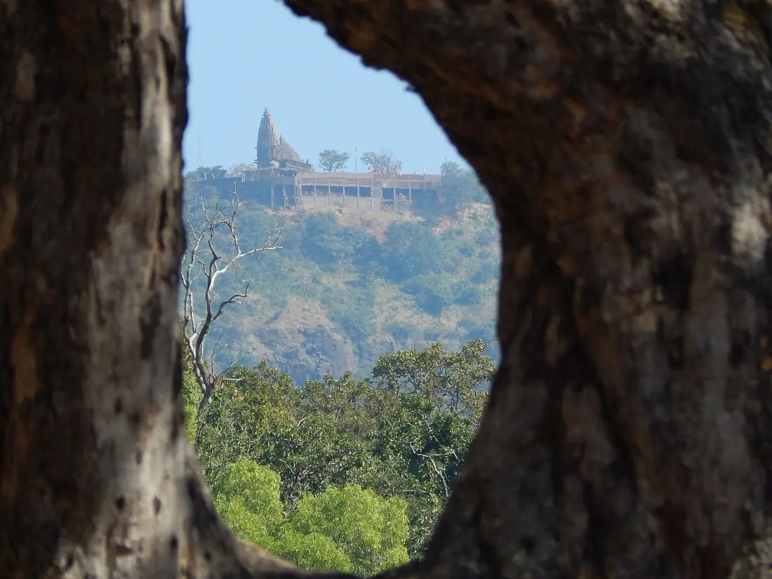
Chauragarh
A Shiva temple on a summit at about 1,330 metres, reached by roughly 1,300 steps. Pilgrims carry iron tridents up as offerings, and thousands stand around the shrine.
- Time
- 3 to 4 hours, up and down
- Effort
- Hard. Not for weak knees or very young children.
- Good to know
- Start by 7 am. Very crowded on Mahashivratri.
Sunset Point in Pachmarhi
Keep this for the end of the day.
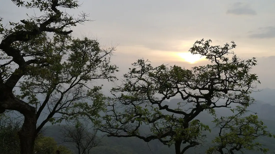
Dhoopgarh
At 1,352 metres, the highest point in Madhya Pradesh and in the whole Satpura range. People come up for one thing: the sun going down behind rows of blue hills.
- Time
- 1.5 hours, including the drive up
- Effort
- Easy. The gypsy takes you to the top.
- Good to know
- Reach 45 minutes before sunset. It turns cold and windy after dark.
Stop. Wait. Let the forest pass.
- Brake gently and stop well short of the animal. Never swerve around it.
- Switch off the horn and the high beam. Noise and glare panic wildlife and can make it bolt into your path.
- Stay inside the vehicle with the engine idling. Keep hands and cameras inside.
- Wait for the whole group. Where one chital crosses, more usually follow.
- Never feed or call to animals. Not the langurs, not the deer.
- Move on slowly once the road is clear. Satpura Tiger Reserve limits speed to 20 km/h for this reason.
Best Time to Visit Pachmarhi
Pachmarhi can be visited all year. The right month depends on what you want to see: full waterfalls in the monsoon, clear days for sightseeing in winter, or cool air when the plains are hot.
| Months | What to expect |
|---|---|
| October to November | Best time The rains have just ended, so the waterfalls are still full and the forest is green. Days are pleasant and nights are cool. |
| December to February | Best for sightseeing Clear, sunny days and cold nights. Pack warm clothes; early mornings can be very cold. Christmas and New Year are the busiest weeks, so book early. |
| March to April | Good. Warm days and fewer crowds. The waterfalls get thinner. Mahashivratri (February or March) brings very large crowds to Chauragarh and Bada Mahadev. |
| May to June | Summer escape Pachmarhi stays cooler than Bhopal or Jabalpur, which is why families come in the school holidays. Afternoons are warm and the falls are at their lowest. |
| July to September | Monsoon The waterfalls are at their fullest and the hills are covered in fog. Paths get slippery, and some forest points can close for a day after heavy rain. The Madhai safari zone of Satpura stays closed in these months. |
How to Reach Pachmarhi
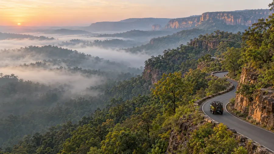
Pachmarhi has no railway station or airport of its own. Everyone arrives by road, most often from Pipariya, the nearest railway station. The last 20 km is a ghat road through Satpura Tiger Reserve, which is the drive shown on this page.
| From | Distance | Time | Good to know |
|---|---|---|---|
| Pipariya railway station | About 52 km | 1.5 hours by road | The nearest railway station. It is on the Mumbai to Howrah main line via Jabalpur, and many trains stop here. Taxis and buses wait outside the station. |
| Bhopal | About 210 km | 4.5 to 5 hours by road | Raja Bhoj Airport, Bhopal is the nearest airport. You can also take a train to Pipariya and drive up from there. |
| Jabalpur | About 245 km | 5.5 to 6 hours by road | Or about 3 hours by train to Pipariya, then 1.5 hours by road. Jabalpur also has an airport (Dumna). |
| Nagpur | About 260 km | 6 to 7 hours by road | The drive goes through Chhindwara. Good if you are flying into Nagpur. |
Distances and times are approximate and depend on traffic and the season. Our Pachmarhi tour packages include pickup and drop at Pipariya, Bhopal or Jabalpur.
Gypsy Tours and Forest Entry in Pachmarhi
Most waterfalls and viewpoints in Pachmarhi are inside the forest area of Satpura Tiger Reserve. These forest points are visited in registered open gypsies, each with a forest permit and a local guide. One gypsy seats up to six people.
How the gypsy routes work
Gypsies run on fixed routes, each covering a group of points. The usual groupings are:
- Waterfall route: Bee Falls (Jamuna Prapat), Apsara Vihar and Rajat Prapat (Silver Fall).
- Caves and viewpoints route: Reechgarh, Handi Khoh and Priyadarshini Point.
- Temple route: Jata Shankar, Bada Mahadev, Gupt Mahadev and the start of the Chauragarh climb.
- Sunset route: Dhoopgarh, timed to reach before sunset.
Booking
Gypsies are booked at the gypsy counter in Pachmarhi town, through your hotel, or through a tour operator. Carry a photo ID for the forest permit. In the busy season (October to February and the summer holidays) book at least a day ahead, as the number of gypsies allowed into the forest is limited.
Routes, timings and charges are set locally and can change. We confirm the exact plan and current rates when you book. In our Pachmarhi packages the gypsy, forest entry and guide are already included.
How Many Days Do You Need in Pachmarhi?
Two full days are enough for the main places. Three days let you climb Chauragarh and see everything without rushing. Add one more day for a jungle safari at Madhai.
2-day Pachmarhi itinerary
- Day 1: Reach from Pipariya by noon. Christ Church, Pandav Caves, Bison Lodge Museum and Jata Shankar. Evening at Pachmarhi Lake.
- Day 2: Morning waterfall route: Bee Falls, Apsara Vihar and Rajat Prapat. Afternoon at Handi Khoh and Priyadarshini Point, then the sunset at Dhoopgarh.
3-day Pachmarhi itinerary
- Day 1: Town places: Christ Church, Pandav Caves, Bison Lodge Museum, Jata Shankar and the lake.
- Day 2: Waterfalls in the morning, Reechgarh and Handi Khoh after lunch, sunset at Dhoopgarh.
- Day 3: Start by 7 am for the Chauragarh climb, then Bada Mahadev and Gupt Mahadev. Leave for Pipariya in the afternoon.
Want this planned for you, with hotel, gypsy and transfers? See our Pachmarhi tour packages for 2, 3 and 4 night trips.
More Places in Pachmarhi
If you have extra time in town, these two are often missed:
- Catholic Church: built by the British in 1892, with Belgian stained-glass windows and an old cemetery beside it.
- Dorothy Deep rock shelters: prehistoric rock shelters on the way towards Dhoopgarh, protected by the Archaeological Survey of India, with old rock paintings of animals.
Places to Visit Near Pachmarhi
Satpura Tiger Reserve (Madhai)
Jeep and boat safaris in the same forest you drive through to reach Pachmarhi. Tiger, leopard, sloth bear and gaur. About 2.5 to 3 hours by road. Safaris run from October to June. Madhai tour packages
Tamia
A quiet hill town in Chhindwara district with a famous view down into the Patalkot valley. About 2 hours by road. Good for a calm night away from the crowds.
Patalkot
A deep, horseshoe-shaped valley about 20 km from Tamia, home to Gond and Bharia tribal villages and known for its medicinal plants. Usually seen on the same trip as Tamia.
Pachmarhi FAQs
Is Pachmarhi worth visiting?
Yes. It is the only hill station in Madhya Pradesh, and in two or three days you can see waterfalls, 2,000 year old caves, Shiva shrines and the highest point in Madhya Pradesh at Dhoopgarh. It is quieter than most hill stations and works well for families, couples and small groups.
What is the best time to visit Pachmarhi?
October to February is the best time for sightseeing, with pleasant days and cold nights. July to September is best if you want to see the waterfalls at their fullest, but expect rain and slippery paths. May and June are good for escaping the heat of the plains.
How many days are enough for Pachmarhi?
Two full days cover the main places. Three days are better if you want to climb to Chauragarh or keep a relaxed pace. Add a day if you also want a jungle safari at Madhai in Satpura Tiger Reserve.
Can we visit Pachmarhi without a gypsy?
Partly. The places in town, like Christ Church, Pandav Caves, Bison Lodge, Jata Shankar and Pachmarhi Lake, can be visited by car, auto or on foot. Most waterfalls, viewpoints and the Dhoopgarh sunset point are inside the forest area, and those are visited by a registered open gypsy with a forest permit and guide.
How much does a gypsy cost in Pachmarhi?
Gypsy charges are fixed locally per route, and the forest entry and guide fees are charged separately. Rates change with the season, so we do not print them here. Message us and we will tell you the current rate for your dates, or take a package where the gypsy, entry and guide are already included.
Which is the nearest railway station to Pachmarhi?
Pipariya, about 52 km away. The drive up the ghat takes about 1.5 hours.
Which places in Pachmarhi need walking or a trek?
Bee Falls has a long flight of steps down and back. Duchess Falls is a steep trek of almost 4 km. Chauragarh has roughly 1,300 steps to the top. Most other places are a short, easy walk from the parking.
Is Pachmarhi good in the monsoon?
Yes, if you like rain and full waterfalls. Carry shoes with grip and a rain jacket, keep a spare day in your plan, and avoid wading in streams after heavy rain.
See Pachmarhi with a local team
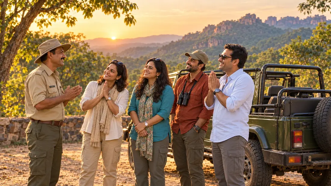
Hotel, pickup from Pipariya, Bhopal or Jabalpur, gypsy with forest entry and guide, all planned in the right order so you do not miss the sunset at Dhoopgarh.
- Planning Madhya Pradesh trips since 2012
- Authorised by MP Tourism
- Price confirmed in writing before you pay
